Drakensberg Grand Traverse

Route Guide

drakensberg-grand-traverse-feature
Photo by Romy Chevallier

The Grand Traverse of the uKhahlamba-Drakensberg is the definitive South African hike (and one of the best in the world in my opinion). It is a formidable experience for the intrepid hiker:  your physical strength and endurance will be tested whilst the ability to navigate, a strong mental aptitude, sense of humour, proper planning and teamwork are all essential elements of completing this bucket-list hike. Add the unspoilt natural beauty and majesty of the Drakensberg, and you have all the ingredients for a truly world-class experience.

The Route

The Drakensberg Grand Traverse (DGT) starts at the Sentinel Car Park and finishes at the Bushman’s Neck Border Post, requiring one to summit Mont Aux Sources, Cleft Peak, Champagne Castle, Mafadi, Giant’s Castle and Thabana Ntlenyana in between. The route between these points is not predefined, but various record attempts through the years have settled on the fastest route which is approximately 205km long when “straight lining” along the most efficient route. In reality, your average hiker will follow contours and river beds on the same route, which should yield a route of between 220km and 240km (excluding any side trips). The recommended route, with GPS waypoints, is shown below.

drakensberg-grand-traverse-full-route
Full route profile. Click to enlarge.

Fitness

The DGT is physically hard, with long sections off-trail and approximately 10 000m cumulative ascent. Add a heavy backpack and it will take fit hikers between 8 and 12 days to complete the route, averaging around 23km a day with 1000m ascent. Some groups prefer to take it easier, doing the route in up to 15 days, which will necessitate a food resupply. For those who have an inclination for fast-and-light excursions, the realistic time will be between 5 and 8 days (the Raubenheimer brothers held the speed record for years, doing it in 4 days and 10 hours).

In in recent years the DGT has drawn the attention of some of the world’s finest trail runners, with our own Ryan Sandes and Ryno Griesel holding the current record at 41 hours 49 minutes! See the video of their incredible athletic feat here.

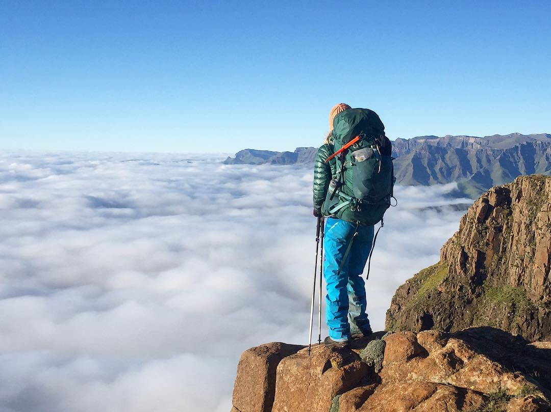
Trails and Facilities

The DGT is a true wilderness experience, with no marked trails, facilities or shops along the way. You will cover a mix of cattle trails and going off-trail cross country. The terrain is not technical: consisting of grass, shrubbery, a few rocky sections and easy river crossings. However, do not underestimate how taxing it will be to walk long distances with a heavy backpack on sloping terrain and climb, on average, 1000m a day!

drakensberg-grand-traverse-terrain

The only people you are likely to encounter are some Basotho herdsmen and other hikers.

drakensberg-grand-traverse-herdsmen

Time of Year

It can be done year-round, but most hikers seem to favour spring and autumn for a mix of mild weather and decent daylight hours. During the height of summer, the Berg is wonderfully green with long daylight hours, but the terrain will be heavy underfoot (lush grass and moist soil) whilst you are guaranteed to encounter thunderstorms. In winter, the days are short but the weather generally clear in between weather systems – your biggest challenges will be freezing temperatures (washing yourself is a real trial!) and the possibility of snow. One must be prepared for any type of weather though – lightning storms, rain, sleet, snow, and gales occur year-round, with heat waves and high-UV days occurring in summer.

drakensberg-grand-traverse-flowers
Picture by Romy Chevallier (@romychev)

Start and Finish

The official DGT starts at the Sentinel car park, up the road from the Witsieshoek Mountain Resort, and gains the escarpment via the Chain Ladders. The route finishes at Bushman’s Neck border post (best accessed via Thamathu Pass). There’s a hiker’s hut managed by Witsieshoek resort which sleeps 12 people, where one can overnight for an early start. 

Navigating the Route

It is essential that you are skilled in and equipped for navigation. Having the full complement of KZN Wildlife Drakensberg Hiking Maps (numbers 1 to 6; scale 1: 50 000) is essential. It is also highly recommended that you have a GPS device with long battery life (and extra batteries), pre-programmed with the waypoints, as well as a print-out of the waypoints. There are a few files available on the internet with waypoints for the route, and there will be slight variations depending on preference and the occasional trade-off between efficiency and more scenic landscapes.

drakensberg-grand-traverse-fog
Dense, low cloud frequently envelops the escarpment outside of the winter months, making a GPS device essential for navigation.

It is also advisable to plot your exact route/GPS waypoints on your map for easy reference and to check their accuracy.

We have used the GPS waypoints at the bottom of this route description. They were published on the Supertraverse website (used with permission) and give an elegant and efficient route.

We have also plotted the route on Google Earth, but with an error margin of approximately 12% to be added to the distances shown on Google Earth due the straight lines between points. The altitude of the route is also slightly mis-calibrated on Google Earth.

Important: note the GPS datum settings and make sure your GPS device(s) are on the correct settings.

The 10-Day Suggested Route

There is a myriad of options regarding the time and exact route to take. This is a suggested route and can serve as a guideline for planning your own route. It follows the Supertraverse DGT Waypoints, with side trips to the Tugela Falls and Mnweni Pass-area, which adds approximately 8km to the overall route.

The campsites shown should be subject to the availability of water, level ground and the safety situation in the area. The “Berg Alert” thread on Vertical Endeavour’s forum should be checked before you embark on jour hike.

It should be noted that incidences of theft are isolated and there are known hotspots to avoid; reasonable precautions should be made however.

Please note that the actual distances are shown in the headings, with the Google Earth route profile showing the shorter “straight line” distance.

drakensberg-grand-traverse-10-day-route-table

Day 1 – Sentinel Car Park to near Fangs

(22,8 km; 1291m total ascent)

drakensberg-grand-traverse-day1-route
Day 1 route profile. Click to enlarge.

The first day is a tough one and it is recommended that you sleep over at Witsieshoek to get an early start (it will also help with adjusting to the altitude). The route starts from the Sentinel car park and gains the escarpment via the Chain Ladders. From there I suggest a quick detour to the Tugela Falls (+1km) before making the slog up to Mont Aux Sources (3282m); climbing 750m in the first 8km of the day. From there the route drops down to and follows the Kubedu river, before cutting across ridges to the valley below Fangs Pass. Many parties start late or take it slow on the first day, which may require camping earlier (at approx.18km) – the distance can be made up on the relatively easy day 2.

drakensberg-grand-traverse-day1a

drakensberg-grand-traverse-day1d

Day 2 – To behind the Saddle

(22,2 km with 767m total ascent)

drakensberg-grand-traverse-day2-route
Day 2 route profile. Click to enlarge.

From Fangs, the route crosses a high ridge before dropping down to the magnificent Hanging Valleys. From there one climbs again to the ridge overlooking the Mnweni cutback, and the plains from where the Senqu (Orange river) springs. The easiest route is to cut across the plains (following the Supertraverse Waypoints), but it would be a shame to miss out on the spectacular views of the Mnweni Pinnacles, Mnweni Needles and Mponjwane Tower – hence a 5,5km detour is suggested, before rejoining the Senqu.  The confluence of the Senqu and Koakoatsan river is a delightful spot for a break (and swim in good weather), from where the route turns up to follow the Koakoatsan valley. Try and make it as far as possible up the valley to take some edge of the very hard (and picturesque) Day 3.

drakensberg-grand-traverse-day2a

drakensberg-grand-traverse-day2f

Day 3 – To near Yodler’s Cascades

(27,1 km; 1305m total ascent)

drakensberg-grand-traverse-day3-route
Day 3 route profile. Click to enlarge.

Crossing the first ridge of the day, you will enter the jaw-dropping domain of Cathedral Peak and the super-scenic Bell Traverse. There are some great lookout points along the way, which may require slight deviations from the route (do not miss the opportunity to peer into the void from the top of the Elephant). Past Tseketseke Pass the route climbs to the 2nd of the must-do summits, Cleft Peak (3277m), from where you can enjoy phenomenal views of the Column and Pyramid. From there it is a steep drop and heart-breaking climb-out again past Thuthumi Pass, before entering the valleys from which the Tlanyaku river springs at Windsor Castle. It is again advisable to make as much ground as possible on this easy final stretch, as Day 4 will be another hard one.

drakensberg-grand-traverse-day3e

drakensberg-grand-traverse-day3
The Column and Pyramid, with Cleft Peak behind, as seen from the foothills. Photo by Jonathan Newman.

Day 4 – To past Ship’s Prow Pass

(22,2km; 1460m total ascent)

drakensberg-grand-traverse-day4-route
Day 4 route profile. Click to enlarge.

From the suggested Camp for Day 3 (near waypoint AL58), the route turns south east, following the river upstream in a long, steady climb for about 6km past the delightful Yodler’s Cascades (another very tempting spot for a swim in warm weather). From there one crosses higher terrain on long slopes covered with knolls and thick grass, staying inland from the escarpment until reaching the final climb up to Champagne Castle (3377m).  The path continues past the dreaded Ship’s Prow Pass, dropping down to some good campsites next to a river.

drakensberg-grand-traverse-day4

Day 5 – To Jarateng river valley

(22,2km; 681m total ascent)

drakensberg-grand-traverse-day5-route
Day 5 route profile. Click to enlarge.

Thankfully an easy day with relatively little climbing, even though one summits the highest peak in South Africa, Mafadi (3450m). Crossing the first ridge after Ship’s Prow Pass, one drops into the Moremoholo river valley – a beautiful hike up a long, gently sloping valley. From there the climb continues up the ridges around Mafadi, and finally up to the inconspicuous flat rock crown perched on the summit. Past Mafadi the route drops down to the Jarateng river, which takes you deep into Lesotho where you will more frequently encounter stone kraals and Basotho shepherds. There are numerous options for campsites but do make sure to cover enough distance – if you manage to stay on track up to day 5, options start to open up for the final 5 days as they are generally easier and your pack lighter.

drakensberg-grand-traverse-day5
A traveller hurries to lower ground as a thunderstorm encroaches the summit of Mafadi (behind).
drakensberg-grand-traverse-day5c
Campsite next to the Jarateng river.

Day 6 – To Lotheni Pass

(23,8km; 1018m total ascent)

drakensberg-grand-traverse-day6-route
Day 6 route profile. Click to enlarge.

A long, gently angled 15km inland climb commences from the Jarateng river all the way up to Giant’s Castle Pass. A there-and-back excursion follows to summit Giant’s Castle (3315m), and it will be tempting to stash you backpacks at the pass (just make sure you hide them out-of-sight and that no one is watching you). After returning to Giant’s Castle Pass, the route drops down to Lotheni Pass – the distance shown for the day ends at the pass, but in reality, one will continue another (easy) kilometre or two to an abundance of campsites.

drakensberg-grand-traverse-day6b

drakensberg-grand-traverse-day6
Horsemanship and showmanship on display near Giant’s Castle.

Day 7 – To Mkhomazi Pass

(21,3km; 794m total ascent)

drakensberg-grand-traverse-day7-route
Day 7 route profile. Click to enlarge.

From the plains below Lotheni Pass the route climbs again steadily to Ka-Masihlenga Pass and Redi Peak (3309m), dropping down past the Hlatimba Caves and crossing the ridge below Mlahlangubo peak. From there it is pretty much down-hill, going around Lamunram Peak and on to the Mkhomazi Pass campsites. 

Depending on where you camp on day 6, the actual distance for day 7 may be as “little” as 18,8km which gives the opportunity to summit Thaba Ntlenyana on day 7 – adding approximately 8km and 650m of climbing to get to the next camp site.

drakensberg-grand-traverse-day7a2
Where we were the day before – Giant’s Castle in the background.

Day 8 – To Pitsaneng River

(26,4km; 1211 total ascent)

drakensberg-grand-traverse-day8-route
Day 8 route profile. Click to enlarge.

From Mkhomazi Pass campsites, the route climbs up the delightful Mohlesi river valley past numerous stone kraals and friendly Basotho herdsmen, to the foot of Thabana Ntlenyana from where a steep 2,5km climb with 450m elevation gain follows. The summit of Thabana Ntlenyana (3482m) is not very dramatic, but there are spectacular views across the Lesotho Highlands from the highest African peak south of Kilimanjaro. From there the route drops to cross the Sehonghong river and climbs back up to the ridge overlooking the plains leading to the Sani Pass road (from where you will desperately wish that the white building next to the road is a store). It is 6km downhill to the road where you are likely to encounter shepherds who have unfortunately become accustomed to begging due to the large numbers of tourists that pass through the area. A further 4km of easy terrain will bring you to a final, stiff climb before descending to the spectacular campsites at the Pitsaneng River. If you have some strength left, you can soldier 3 to 4km on to the escarpment at Sandleni Pinnacle for more picturesque campsites and stunning sunrise views.

drakensberg-grand-traverse-day8a

drakensberg-grand-traverse-day8b

Day 9 – To Leqooa River camp/Mzimude Caves

(21,3km; 1025m elevation)

drakensberg-grand-traverse-day9-route
Day 9 route profile. Click to enlarge.

From the Pitsaneng river one cuts across a ridge to enter the Sandleni Pinnacle area below No Man’s Peak which offers great views from the escarpment (albeit not as dramatic as the northern Berg). From No Man’s Peak the route drops past Mzimkhulu Pass, before crossing a ridge into the Mashai Pass area. A generally pleasant and easy walk to the Mashai campsite is followed by a steep climb to cross the ridge below Mashai Peak (3310m) and then back down to the Leqooa river where one can find some campsites. The Mzimude caves are also nearby (indicated on the map). The next campsites are past Isicatula Pass, some 4,5km further on.

drakensberg-grand-traverse-day9a

drakensberg-grand-traverse-day9b

Day 10 – To Bushman’s Nek Border Post

(20,7km; 468m total ascent)

drakensberg-grand-traverse-day10-route
Day 10 route profile. Click to enlarge.

Day 10 is a victory lap – a brief 200m climb from the Leqooa river will take you onto the ridge leading to Isicatula Pass, where I once got horribly lost in thick fog due to following the waypoints straight to Thamathu Pass instead of dropping down south-west to AB141. A pleasant and fast walk will take you around to Thamathu Pass, where it may take some searching to stay on the right track down to Bushman’s Nek – the most efficient route following the ridge. There’s a last river crossing before you touch the gates at the Border Post to complete an epic hike: high fives and beers are in order, as well as a main course or three at the Bushman’s Nek Hotel.

drakensberg-grand-traverse-day10b

drakensberg-grand-traverse-day10

The Supertraverse Drakensberg Grand Traverse Waypoints can be downloaded here.

For any queries about fees or booking procedures, contact Ezemvelo KZN Wildlife on +27 33 845 1000 or bookings@kznwildlife.com

Make use of our Multi-Day Hiking Checklist to help you pack all the essentials and always practice the Leave No Trace Principles to ensure sustainable enjoyment of the outdoors.

mm
About Willem Boshoff 25 Articles
Willem is an actuary by profession and an adventurer at heart. He spends as much time as possible outdoors - camping, hiking, mountain biking, surfing and rock climbing are his activities of choice – and he enjoys reading and writing. He has hiked and trekked in the Himalayas, Andes, Patagonia, Alps, Corsica and done the Camino Portugues, and thinks locally the Cederberg and Drakensberg offers some of the best wilderness-hiking experiences in the world. He is also passionate about conservation and sustainability. He lives in Cape Town.

34 Comments

  1. Thank you !! This is dacinating- I have done Mafadi , stilll want to do thabananthlenyana- but now sure if I want to do Mafadi route again , I had done it through injisuthi.

    Do you coordinate those tours as well

    • There are basically three options for food:
      1. Carry everything for the whole trip
      2. Hike down after five days for a resupply
      3. Hire a porter for the first half

  2. Wow this is what i need. How much is the trail fee if i carry everything myself and no guide? How many people are allowed to start a hike in a day?

    • I tried this 2 and a half years ago. Can’t remember the fee but it is minimal. Whatever the park fee is for entering Bushman’s neck or Witsieshoek is depending on where you start. The article mentions R100. I don’t believe there is an actual limit on the number of people. There are not people doing this. The most challenging part is the planning and logistics. If you park your car at one side you need do get back to it somehow. I once started at Bushman’s neck and went down Grey’s pass in the Champagne castle area. My friend and legendary trail runner drove me 20km from Winterton back to Bushman’s neck. When we got their I realised I forgot my keys at his house in Winterton. Long story short, with the help of the border guards we broke into my car and hotwired it. Hat’s of to Ian for staying calm and not fighting woth me. We are friends today lol.

  3. Need a shuttle from Bushman’s nek to sentinel car park ,planning to do Drakensburg GT ,is there any you can recommend?

  4. I would love to do the grand traverse. Can anyone please tell me who to contact.
    Many thanks.
    Regards Debbie Garrod

  5. Hi David,I’m planning my first traverse together with 3 others..We don’t want a guided hike..Do I have to contact anyone in advance or can we just go to the car park on our start of traverse?

  6. Hi guys, I’m hoping to walk the North Drakensberg Transverse in March 2020 solo. Do many people do the trek solo?Could I expect to bump into many other hikers on the route?

    • During the summer water is abundantly available in the Drakensberg. Winter will be more tricky.

  7. I’m considering the DGT in early July (3- 13) due to holiday schedules and work. Will be flying into SA. Are the shuttles/buses to from the area? Water in July? Are there sources regularly? Lastly, will a -10 C bag be enough? Other helpful hints appreciated.

  8. Sweet write up, but it would be really useful if you’d shown the suggested route on google maps from directly above. Its tough to follow along on the berg maps because everything is distorted at that angle.

  9. Is it possible to do a shorter version of the full traverse…to come down at giants castle for example?

    • yes, one has a few options. A few years ago a group of us went up Langalibalele, walked an awe inspiring 5 days, and came down at Greys pass. I highly recommend.

  10. Does anyone know where I would be able to get a GPX version of the GPS co-ordinates given here?

    We are looking to do the GT in March and it seems that every GPX of the Traverse I can find is different. Also, I’m lazy and would prefer not to have to manually input each one of these co-ordinates.

    Regards,
    Pierre

  11. Great article. Did the GT in the early 1980’s when a member of the Durban Rambles Club. Start at Chain Ladder, replenish at Sani, end with a celebration party at the lodge at Sehlabathebe National Park. Still have my old Mountain Club maps with the caves (overhangs) hand marked which we regularly used for shelter on this and many other trips over the years. Also had a 2 man Kestral tent which I still lend out to others here in NZ 🙂

  12. Great write up. I’d love to do this trek however I live in the States, would prefer not to do it alone, and don’t know anybody here who’s willing to take it on. Does anybody know of any networks to connect with others planning to go?

    Thanks!

  13. Thank you for this. This post has been my blueprint for a journey I just completed few days ago. I did my 10 day DGT following this guide and it was exactly as written.
    What an experience 🙏

Leave a Reply

Your email address will not be published.


*