
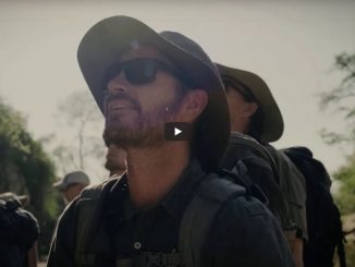
Malolotja Nature Reserve includes over 18 000 hectares of mountain wilderness in the north-west of Swaziland. The reserve provides protected wetland, woodland, highveld grassland and mistbelt forest habitats for a wide variety of plant and animal life.
Beauty: 4.5/5
Difficulty (fitness): 8/10
Technical rating of trail: Standard trail walking. No flat areas – either steep up or steep down. Path can disappear – GPS or map reading skills essential.
Friday, 12 January 2018
Being resident in Nelspruit, we were able to leave home by 13H30. We travelled through the Oshoek Border post and, although it’s normal for the border to be busy on a Friday afternoon, everything went well and it was a pleasant experience at both border posts. Don’t forget to ensure you have R50 or 50 Elangeni cash to pay your Swazi road tax. They do accept cards but it takes longer to process.
Once in Swaziland we headed for the Malolotja reserve main camp (26° 8’25.67″S. 31° 8’8.87″E). We never made prior arrangements as we were not using the local accommodation and intended to hit the trail as soon as we arrived.
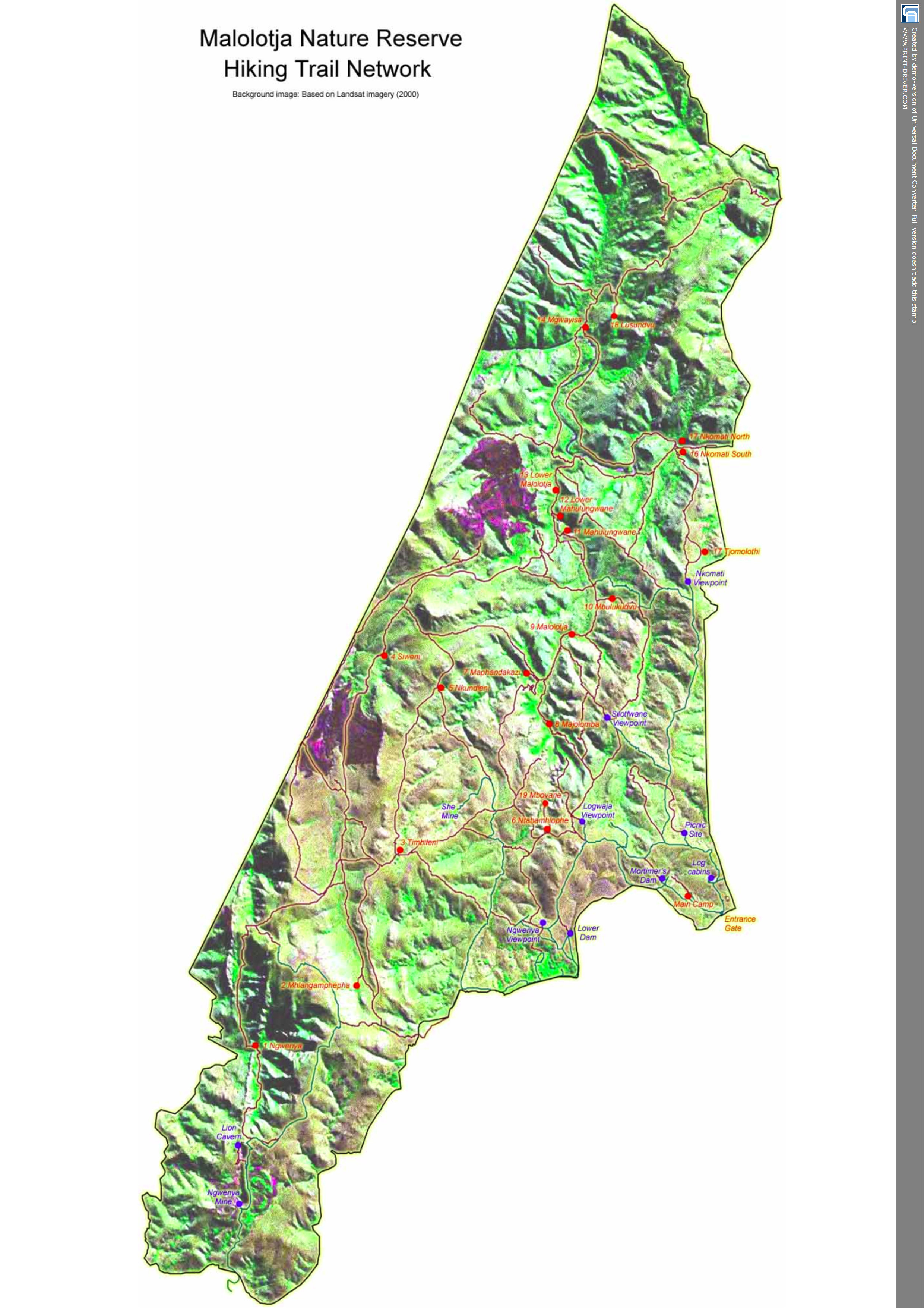
Once at the main camp we were greeted in the typical friendly Swazi fashion. We booked and paid for our two nights in the reserve. Make sure you have your own printed or electronic map of the reserve and trails as they no longer supply maps at reception.
We left the main camp by 16H00 and headed past the campsite via Mortimas Dam in a Northwesterly direction towards Logwala lookout. This is mostly well-defined trail and road network – the real hike starts after the lookout.
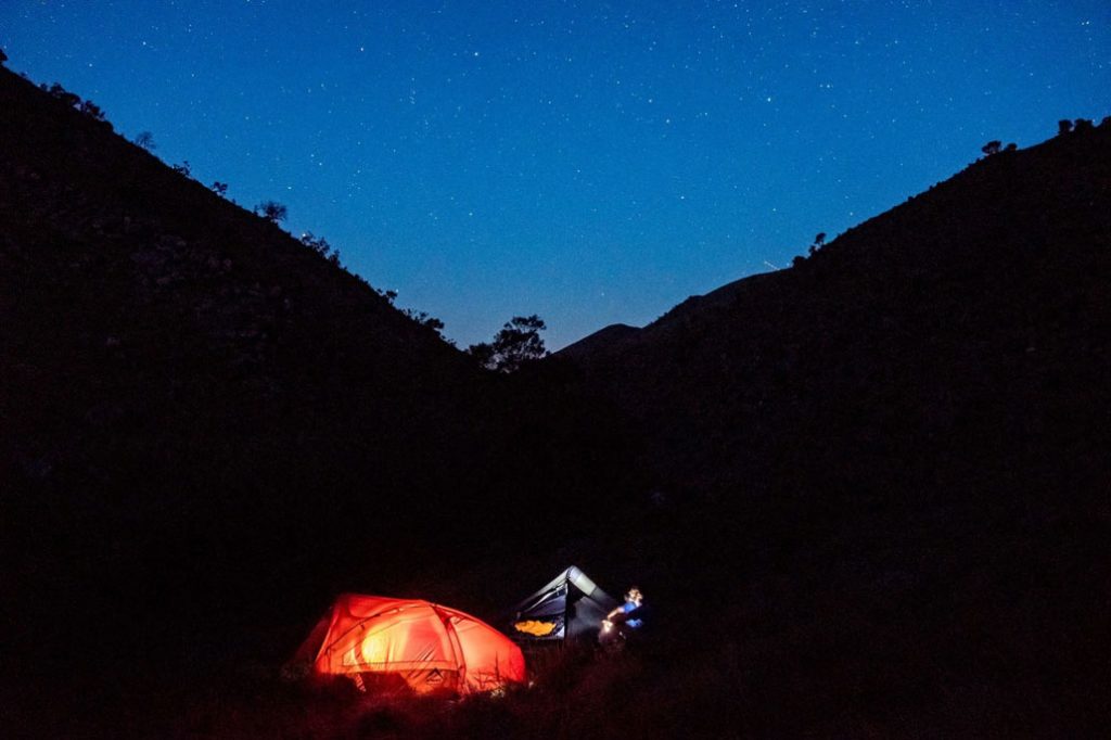
Our target before dark was camp #6 next to the river. We made it with enough time to pitch our tents. We enjoyed an awesome starlit night and banked a good night’s rest.
Saturday, 13 January 2018
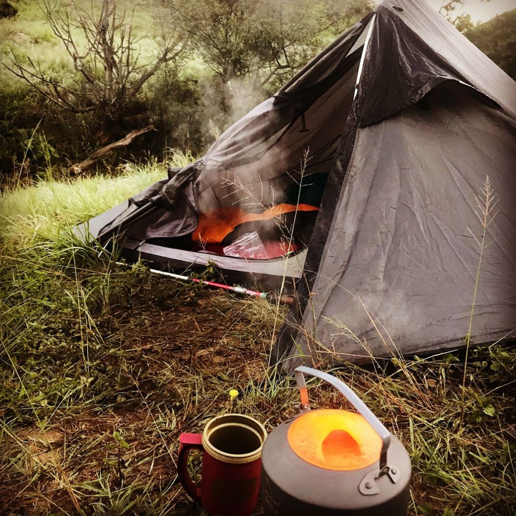
Early start, coffee, breakfast and we hit the trail. We had two options to get to camp #7 a short way and a long way. The weekend had turned out to be blistering hot with “heatwave warnings” so we opted for the short route.
We climbed out the valley to an awesome site. In the far distance was Silotwane Peak, the entire valley below was covered in mist and in the foreground not far from us were no less than five different antelope species.
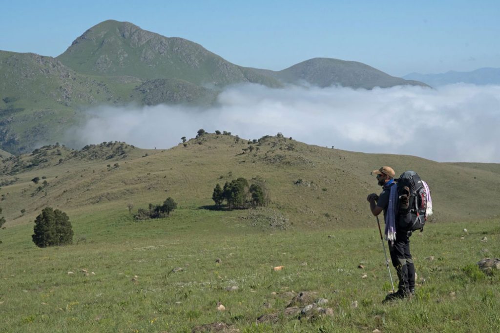
The Eland, Hartebeest, Black Wildebeest, Zebra and Blesbok were grazing in the early morning light. The soaring of a Steppe Buzzard and Black Saw-wing (Swallow) and most importantly a glimpse of the endangered Blue Swallow. All were aware of our presence but not spooked, we simply sucked in the beauty and took time to remember how privileged we were!
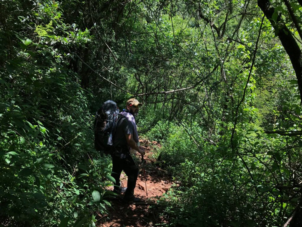
Once we set off again we found the landmark “zig zag” or cut back path, which would lead us rapidly down into the riverine forest. While descending, the environment changed from Montane Grassland to rather dense Riverine forest. With this change, the sights and sounds also changed. The summer screamers or Cicadas (cicadas are a superfamily, the Cicadoidea, of insects in the order Hemiptera) were deafening and the birdcalls increased. The elusive Eastern Nicator clearly calling but impossible to see.
Once down along the river it was an easy trail to camp #7. For the first time ever on a trail, we had reached our destination before lunch. 11H00 to be exact! We pitched tents and had a swim in the ice-cold river, feeling fresh again after lunch and a swim we decided Silotwane Peak was do-able. Without our backpacks, just water and sun protection we decided at 12H00 to summit Silotwane!
We set out bushwhacking the shortest route out of the riverine forest and back onto the grasslands. There is no problem identifying the correct peak, it is simply the highest one you can see. We knew that the peak was about 4km to the top and allowed a maximum of three hours before we had to turn and head for camp before nightfall.
We found a stream half way up, and I must add that water was never an issue on this trail; however, careful planning in the less plentiful months would be essential. We filled our water bottles and pushed up the last section.
We peaked shortly after 15H00, (1666m, 26° 5’13.34″S 31° 4’28.84″E) an absolute awesome view, looking to the West was South Africa and the rest was the beautiful Malolotja. Time being tight we started our decent. Tough on the knees and legs, we travelled the same path and were back in camp with plenty light to spare. We soaked our feet in the cold river water, had dinner and hit the sack!
Sunday, 14 January 2018
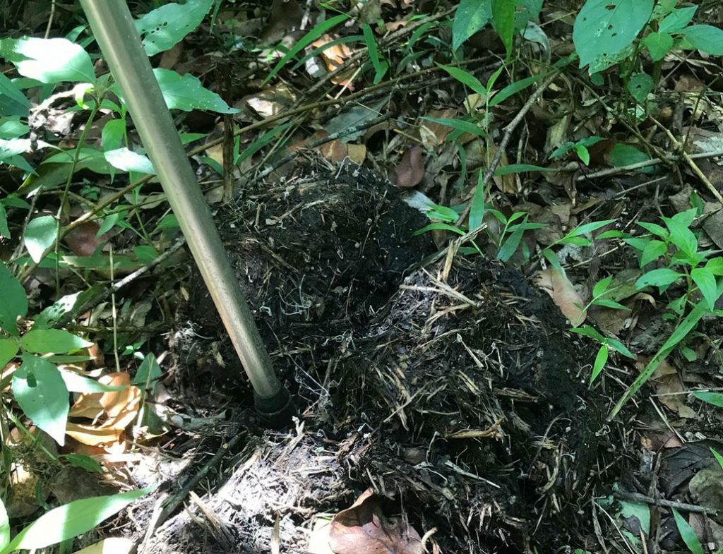
Again an early start was easy; we had breakfast, coffee and packed up. We planned to head back along the river on the marked trail to camp #8 and then ascend out the valley back to the Logwala lookout. All was good until the path disappeared. We bumbled around in the bush for over a half an hour looking for the path. We noticed definite Elephant dung, old, but all the same it was unnerving to know that these giants could be about in the very confined bush.
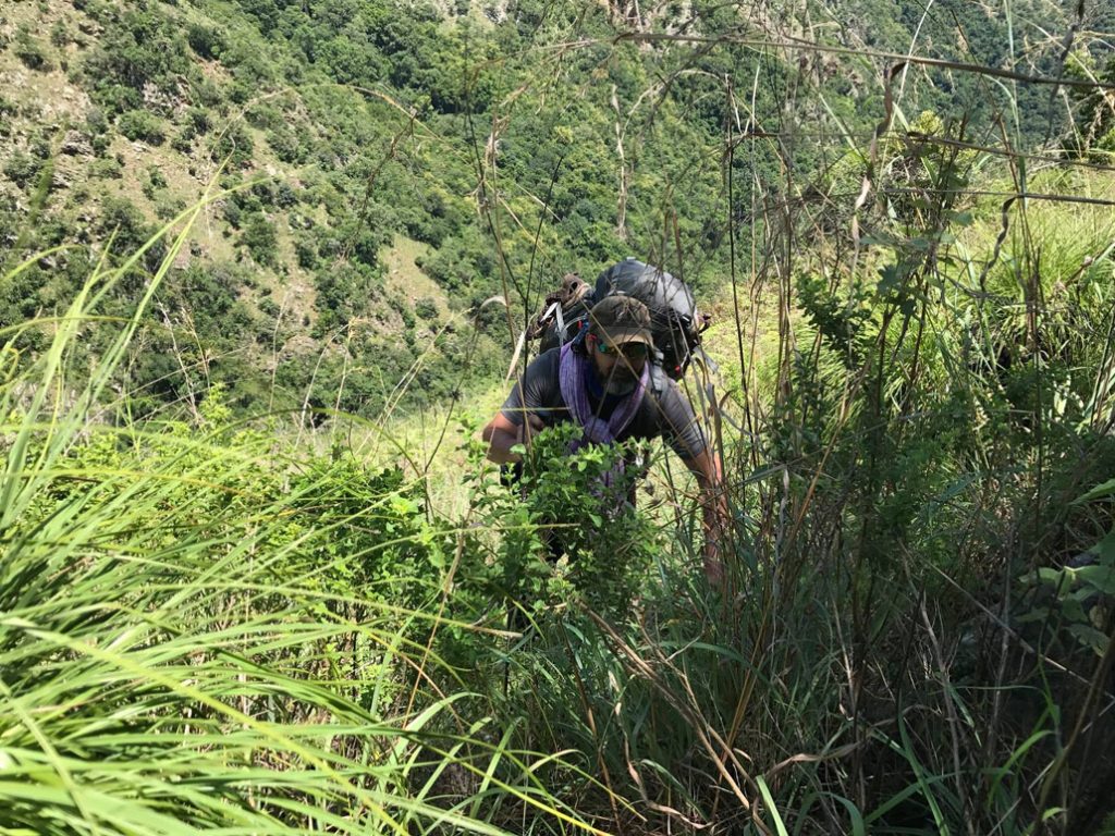
We eventually found a stone cairn across the river and picked up the trail again. We found Camp #8, which confirmed our position. Shortly thereafter, the trail dried up again. Knowing where the track was heading we decided to tackle the thick riverine forest and take the shortest route up. This proved to be a grueling exercise; we persisted, albeit a snail’s pace and eventually intersected the correct path.
Although we were back on the track the gradient was no less as we climbed out the valley. The view of the Malolotja Waterfall was a good reason to stop, catch our breath and take a pic.
As we approached the lookout, we were hoping to hitch a lift back to main camp, but as luck would have it, not a vehicle in site. This meant a midday push of 4km back to main camp.
We reported back and bought an ice cold Sibebe. We ordered a late lunch and drove down to the camp site for a nice, long shower and clean clothes.
After lunch we headed back to Nelspruit and again both border posts were a pleasant experience. We were back in Nelspruit by 18H00.
Conclusion
All in all Malolotja Swaziland was an awesome hiking experience. Great place, great people and great value for money. I would encourage all who can, to go and experience the grandeur and beauty of the Malolotja Reserve.
We enjoy the path less travelled; Malolotja is up there with the Drakensberg and Wolkberg.
Should anyone need our tracks or any information pertaining to the Malolotja reserve please do not hesitate to contact me.
Click here for a map of the reserve and here for a map of estimated walking times between camps.
Malalotja Contact details
Phone/ Landline (+268)24443241
Mobile: (+268) 7660 6755
Email: culturalvillage@sntc.org.sz
Alternatively, all information is available on the following websites:
Who can we contact to get hold of the maps, please?
Hi Riette, sorry about that. The article has been updated with links to a map of the reserve as well as a map of estimated walking times between camps. I’ve included the links here as well:
http://www.hikingsouthafrica.co.za/wp-content/uploads/MaloltjaTrailstest.jpg
http://www.hikingsouthafrica.co.za/wp-content/uploads/MalolotjaTrailsTimes.pdf
I have been hiking Malolotja since 2007. Thats 11 years. Some years up to 4 times.
The area is amazing.
We also found the elephant dung back in december last year.
We also know an area where we have found a leopard twice.
My new 10 year destination is wolkberg wilderness.
Hi Lukas,
I am currently planning a trip with a few of my friends to Malolotja.
Will you be willing to help with a few things?We don’t really know where we should plan to camp and I’m struggling to find more info regarding the best routes and camping spots.
Thanks
Wian.
Hi Steven,
next August I’ll be traveling with my wife to SA and Swaziland for the first time, and we’d like to spend a couple of nights at the Malolotja camp, doing a short hike during the day. Do you have any particular suggestion?
I am 42 and my wife 35, we are reasonably fit as we are do frequent hikes in the Italian Alps.
Thanks!
Best,
Stefano
Hi Stefano, try posting your question on our community forum as well: https://community.hikingsouthafrica.co.za/
Thank you!
I will do it.
Best,
Stefano