
Beauty: 8/10. Mountains, rivers, rock pools and waterfalls… Bliss! After leaving Eerste Tol behind, one is immediately ensconced in the rugged Cape mountains.
Difficulty: 6/10. Moderate to good fitness and good balance is necessary.
Terrain: Standard trail walking with varied terrain depending on route chosen. Trail splits can be confusing. Last section of trail gets very steep – caution is advised.
It must be said upfront that the CapeNature Bainskloof hiking area offers a number of well-maintained trails for a range of fitness and technical ability, as well as some of the most easily accessible day trails in the greater Cape Town region – especially if one is looking for rockpools!
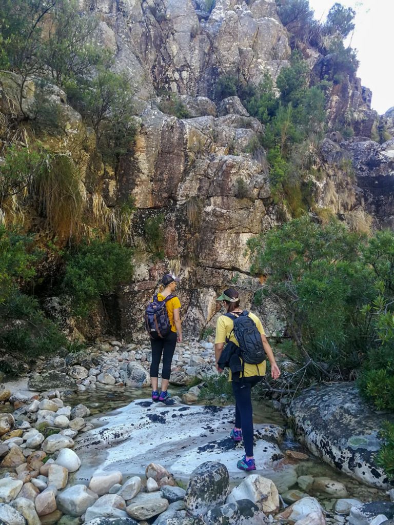
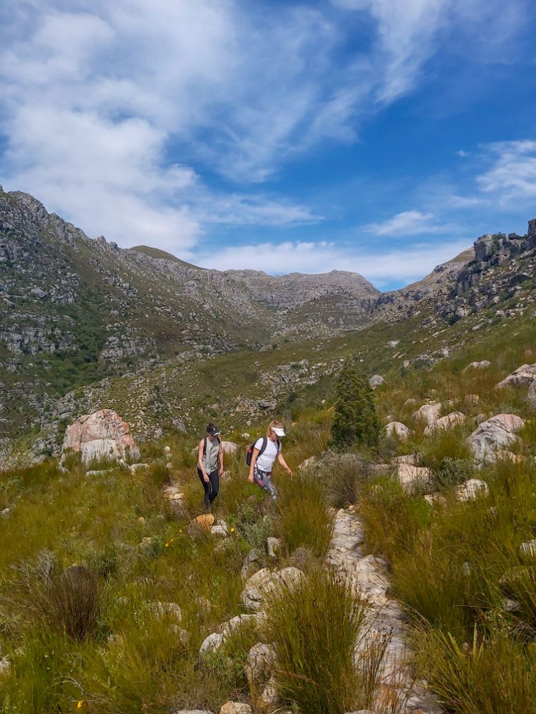
For that reason, the Bobbejaansrivier trail is a beautiful trail best enjoyed in summer. It is a linear route that totals approximately 10kms (“out-and-back”), depending on how far you walk in. The trail starts at the Eerste Tol/De Nek parking area, and heads immediately down to the Witterivier. Look out for the yellow painted footprint when crossing the river, to find the best way across. You cross the Witterivier and head up the opposite side, for an easy walk along a meandering contour above the Bobbejaansriver tributary.
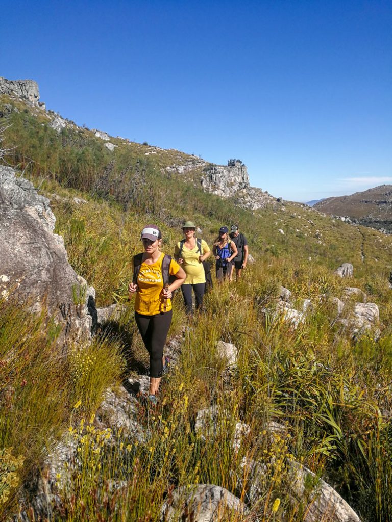
After a kilometer or two, you will see some rock outcrops which, while fantastic, offer minimal shade. At this point, you will lose sight of the Bainskloof pass (and the sounds of any traffic). This is a good time to pause and soak in the mountainous slopes that enclose you in the valley and the beautiful view of the gushing river below.
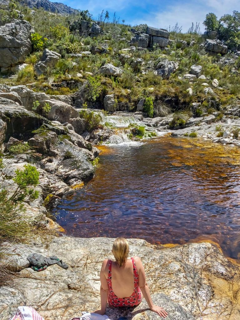
Shortly thereafter (at approximately 3.5kms) is the first turn-off to the river. Cairns mark the trail split, and you will see a series of beautiful waterfalls below. A steep descent will get you down to these beautiful falls, and the first opportunity for a dip. Here, the path is not so clear and losing the marked route may require some easy boulder hopping to get to the waterfall.

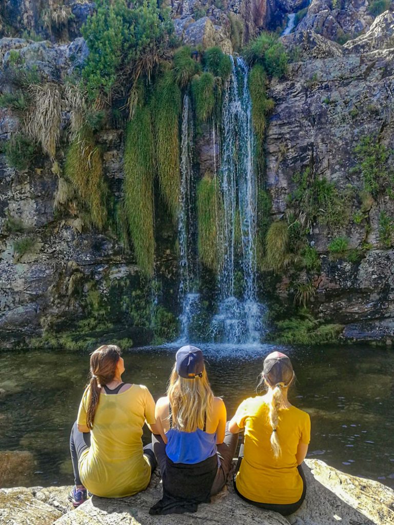
Continuing along the main trail instead, another – lesser used – path will also take one down to the river, but the main trail winds on, with a slight incline before the valley opens up ahead of you. If you are in luck, you should be able to see the magnificent three-tiered waterfall in the distance, at the head of the valley and below Klein Wellington-Sneeukop peak.
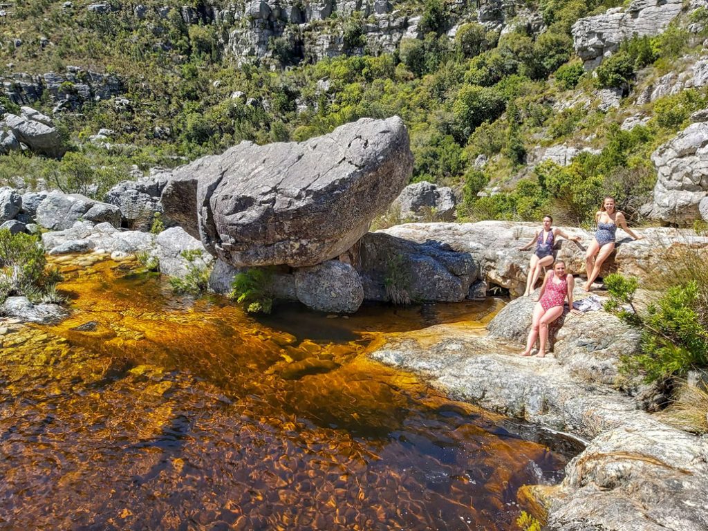
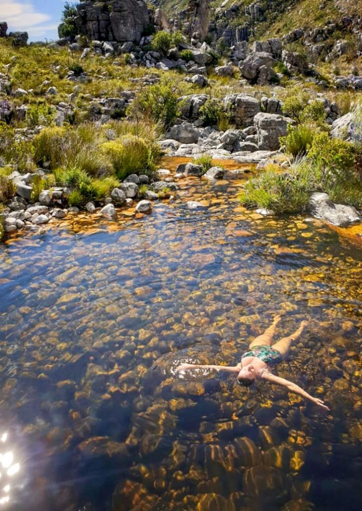
At this point, one can continue on straight towards the head of the valley and the main three-tier waterfall feature, or take another trail split down to the river to enjoy a series of sublime pools and flowing waterfalls.
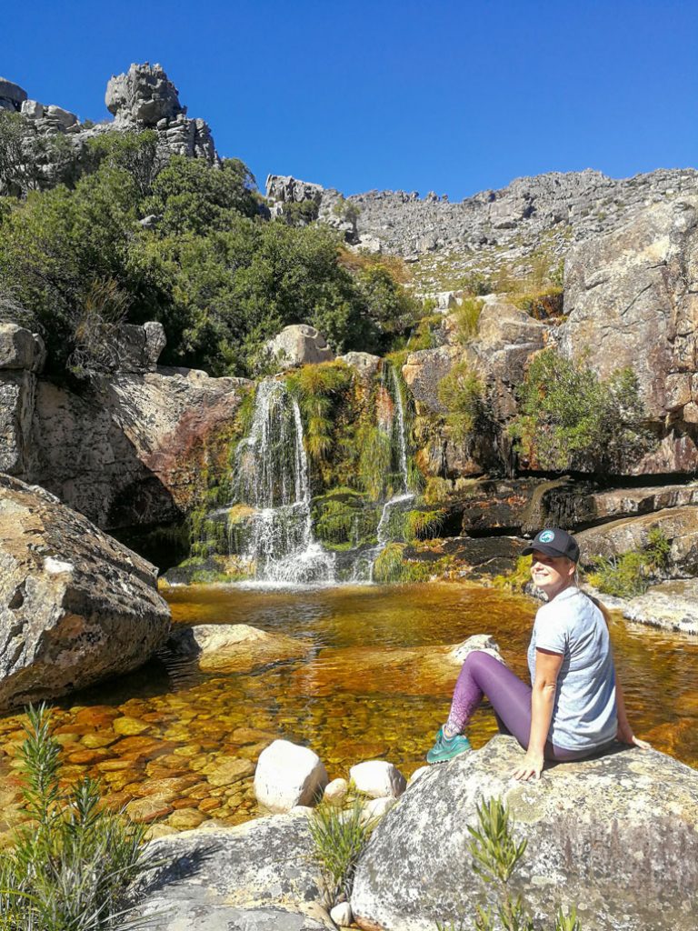
If one continues straight to the main waterfall, note that the trail will split once more: taking the right split will lead one straight up the side of the mountain slope via the Mountain Club of SA route and to the vlakte that overlooks the top of the waterfall. Keep your eyes trained for the left split to the waterfall, as it is easy to miss. You will continue along the valley for a while, but be sure to expect a bit of a sudden ascent when you near the ravine.
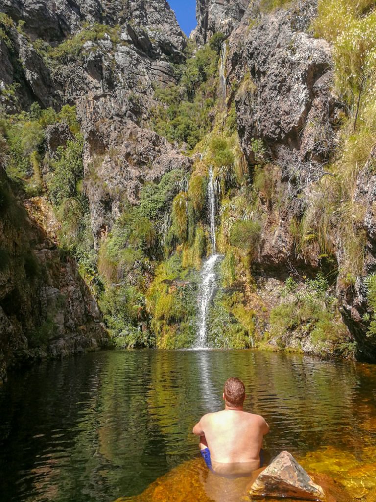
Should one wish to get to the three-tiered waterfall at the head of the valley, suitable scrambling skills and a head for heights are needed, as the last section is steep and tricky to navigate. This is not recommended for small groups or after heavy rains. The path disappears at this point and if in doubt, it is not worth continuing as this section is slippery and can be dangerous.
Conclusion
All in all, Bobbejaansrivier trail is a delightful day out, in an untouched valley enclosed by a bowl of mountains – and even though you may be just more than an hour’s walk back to civilization, it will feel as if you have been immersed in the most isolated corner of the Cape Mountains.
Bookings/Permits
The Bainskloof area is protected and managed by CapeNature. Permits are necessary for all trails in the area, and cost is dependent on the number of people in your group. Please respect the use of the area and those who also wish to enjoy it by adhering to the CapeNature rules.
For more information call CapeNature on 087 087 8250, or email reservation.alert@capenature.co.za.
Download the Limietberg Hiking Brochure here.
Tips
- It is recommended to print out two copies of your permit – one to carry with you, and one to leave on the dashboard of your car. The rangers are known to check both hiking groups and vehicles, and you can be fined should you not have the relevant permit to enter the area or for your group.
- Always carry water, even though you will walk near to the river for some of the route. Ensure that every person in the group has a hat to prevent over-exposure, as well as a warm jacket for post-rockpool swimming. There are some lovely spots next to the river for picnicking – please carry everything out that you brought in, including fruit peels, so that the next group can also enjoy the pristine environment.
- As with all hiking, start as early as possible to avoid midday sun or afternoon heat – depending on the pace of your group, the first turn off to the river could take up to (or more than) an hour to get to, and there is little shade en route.
- The Bobbejaansrivier Trail can be catered to a group’s needs: as an all-day affair, spent hiking and exploring the different offshoots of the trail and the numerous rockpools and waterfalls, or it can be a relatively quick half day hike, if you know exactly where you are going or want to be and can move fairly fast.
- There is something for everyone on this trail – don’t necessarily be lured by the three-tiered waterfall at the end of the trail, as the easily accessible rockpools of the Bobbejaansrivier are a welcome respite and a wonderful reward at any point along the hike.
I grew up in Wellington and remember my Dad taking our family out to this area for a Sunday braai and us kids always loved the pools and rock hopping. There used to be fish in the river that you could watch swim beneath you.
I have emailed the given adress for the Bobbejaansriver Trail TWICE but with no reply!!!!!!
I am very eager to explore this trail and only have a few questions regarding THE PERMITS. PLEASE RESPOND!!!!!!!
Cape Nature has been having trouble with their email system for a few days now. Try calling them: 021 483 0190, 021 871 1535 or 087 087 8250.
How safe is the bobbejaansriver trail for a solo woman